The best Gatineau Park view isn’t found on the most difficult trail, but through local knowledge of timing, access, and true effort.
- Trail ratings can be deceptive; a “moderate” trail’s elevation gain can be more challenging than a “long” trail’s distance.
- Peak season success relies on strategic parking (arriving before 9 AM or using alternative lots) and matching your destination to the time of day and year.
Recommendation: Prioritize trails like King Mountain or the lookouts on the parkways, but use the “trail intelligence” in this guide to plan your visit for a high-reward, low-stress experience.
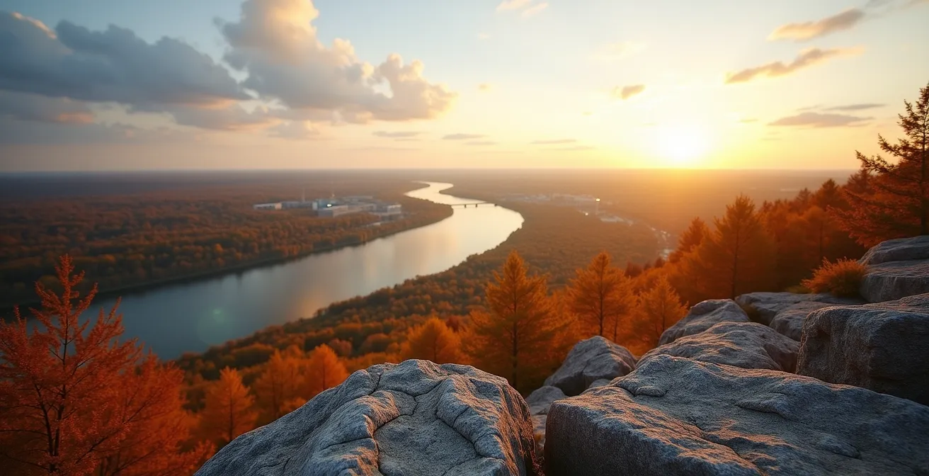
For any outdoor enthusiast in the National Capital Region, the allure of Gatineau Park’s sweeping vistas is undeniable. You’ve seen the photos: brilliant autumn colours blanketing the hills, the Ottawa River winding through the valley, the city skyline in the distance. The immediate question is always, “Where is that?” followed by a more hesitant, “And how hard is it to get there?” The common advice often points to a few famous spots, suggesting that a great view requires a grueling, multi-hour trek only suitable for the ultra-fit. This can be discouraging for the occasional hiker or visitor who wants a spectacular payoff without an elite-level workout.
Many guides will list trails by distance or a simple difficulty rating, but this often hides the true nature of the effort required. They might mention Champlain Lookout as the go-to spot, but neglect the reality of peak-season crowds. This approach overlooks the most valuable tool for exploring the park: local knowledge, or what we can call “trail intelligence.” It’s the understanding of nuances like parking logistics, seasonal timing for sunsets, and crucial safety protocols that genuinely separates a frustrating outing from a memorable adventure.
But what if the key to unlocking the park’s best views wasn’t about pushing your physical limits, but about hiking smarter? This guide moves beyond generic ratings to provide a strategic approach. We’ll decode the real effort involved in popular trails, reveal the local hacks for avoiding crowds, and equip you with the specific knowledge needed to choose the right trail, at the right time, for the best possible experience. We will explore why some trails are harder than they seem, how to master parking on a busy fall weekend, and how to pack for a perfect day that transitions from the trail to a table in Chelsea. This is your guide to achieving the maximum scenic reward for your effort.
This article breaks down the essential local knowledge you need to conquer Gatineau Park and Ottawa’s Greenbelt like a seasoned pro. From decoding trail difficulty to finding the best fall colours, the following sections provide a complete roadmap for your next adventure.
Summary: Your Guide to Gatineau Park’s Effortless Views
- Why the “Wolf Trail” Rating Deceives Many Occasional Hikers?
- How to Park at King Mountain on a Saturday in October?
- Champlain Lookout or Étienne Brûlé: Which Has the Best Sunset?
- The Tick Prevention Mistake That Ruins Hikes in the Gatineau Hills
- When to Switch from Hiking Boots to Micro-Spikes on the Trails?
- When to Visit the Greenbelt to Catch the Fall Colors at Their Peak?
- How to Pack for a Weekend That Includes Hiking and Fine Dining?
- How to Explore Ottawa’s Greenbelt Trails Without a Car?
Why the “Wolf Trail” Rating Deceives Many Occasional Hikers?
The Wolf Trail (Trail 62) is often recommended as a quintessential Gatineau Park experience, but its “difficult” rating doesn’t fully capture *why* it challenges so many hikers. While the park boasts a 4.4-star average rating across its 229 trails, the Wolf Trail consistently emerges as one of the most demanding. The deception lies not in the distance, but in a combination of factors that casual hikers often underestimate, leading to exhaustion and frustration.
The primary misleading metric is the elevation. The trail involves a 294-metre elevation gain. To put that in perspective, it’s like climbing a 97-story building. This is significantly steeper than the 88-metre rise of Parliament Hill, a landmark many Ottawa residents are familiar with. This steepness is concentrated in several sections, requiring scrambling—using your hands for balance and propulsion—over rocky terrain. This isn’t just walking uphill; it’s a full-body workout that demands proper, sturdy footwear and hands-free movement, meaning backpacks are essential over shoulder bags.
Furthermore, the advertised time of 2.5 hours is optimistic for anyone but a seasoned trail runner. A more realistic plan for an occasional hiker should budget for 4 to 5 hours, including necessary breaks for water, snacks, and enjoying the viewpoints. Finally, the trail’s path isn’t always straightforward. There are multiple unmarked junctions where a wrong turn is easy to make. Relying on your phone’s GPS can be risky due to spotty service, making map-reading skills or a pre-downloaded map a critical piece of gear. These combined factors—steep scrambles, extended duration, and navigational complexity—are what truly define the Wolf Trail’s difficulty, making it a poor choice for those seeking a view with minimal effort.
How to Park at King Mountain on a Saturday in October?
King Mountain is one of Gatineau Park’s crown jewels, especially during the fall colour season. However, this popularity means its small parking lot fills up with astonishing speed, particularly on a clear Saturday in October. Simply showing up mid-morning is a recipe for disappointment. Successfully parking here requires “trail intelligence” and a strategic approach that goes beyond just hoping for the best. On peak weekends, the National Capital Commission (NCC) often implements intermittent road closures in the southern sector when parking lots reach capacity, making a solid plan essential.
Your strategy should be based on timing and having backup options ready. Here is a breakdown of the most effective local hacks for securing a spot:
- The Pre-9 AM Club: This is the most reliable method. Arriving at the King Mountain parking lot before 9:00 AM during the peak fall season (late September to mid-October) all but guarantees you a spot. By 10:00 AM, the lot is almost always full.
- The P7 Alternative Route: If the main lot is full, don’t give up. Drive to the larger P7 parking lot at Meech Lake. From there, you can take a scenic approach via Trail 30, which connects to Trail 8 and then Trail 37, leading you to the King Mountain loop. This adds about 4.2 km of beautiful, rolling terrain to your hike but ensures you can still access the trail.
- The Post-3 PM Strategy: Many morning hikers begin to leave in the mid-afternoon. Arriving after 3:00 PM often yields open spots and has the added benefit of letting you catch the spectacular golden hour light from the lookouts.
- Real-time Intelligence: Before you even leave home, check the “Gatineau Park Trail Conditions” Facebook group. Local hikers often post real-time updates on parking availability, saving you a wasted trip.
This proactive approach, combining early arrival with knowledge of alternative routes, transforms parking from a source of stress into a manageable part of your hiking plan. It’s a perfect example of how local knowledge is more valuable than luck when exploring the park’s most popular sites.
Champlain Lookout or Étienne Brûlé: Which Has the Best Sunset?
For sunset chasers in Ottawa-Gatineau, the parkways offer two premier, easily accessible destinations: the famous Champlain Lookout and the slightly more subdued Étienne Brûlé Lookout. While both provide breathtaking views, they are not interchangeable. Choosing the “best” one depends entirely on the time of year and your tolerance for crowds, a key piece of seasonal sync in your trail intelligence toolkit. Both are typically accessible until 30 minutes past sunset before the parkways close for the evening.
Champlain Lookout is the park’s most iconic viewpoint. It faces directly west, offering a panoramic vista over the Ottawa Valley. This direct orientation makes it the undisputed champion during late summer (July and August), when the sun sets perfectly in its line of sight. However, its fame comes at a cost: it is almost always crowded, with dozens of people vying for the best photo spot. The experience, while visually stunning, can feel more like a public event than a peaceful communion with nature.
Just a short drive away, the Étienne Brûlé Lookout offers a different experience. It requires a short walk from its parking area, which immediately filters out some of the traffic. Its orientation is slightly southwest. This subtle shift makes it the superior choice for autumn sunsets (September and October), as the sun’s position moves south along the horizon. The view frames the setting sun over the rolling hills, often with fewer than 10 other people present. This creates a much more intimate and tranquil atmosphere, significantly increasing the effort-to-reward ratio for those seeking serenity.
The following table, based on insights from local guides, breaks down the key differences to help you make the right choice for your next sunset adventure. As highlighted in a comparative analysis by local explorers, the best lookout is all about timing.
| Feature | Champlain Lookout | Étienne Brûlé Lookout |
|---|---|---|
| Orientation | Direct West | Southwest |
| Best Season | Late Summer (July-August) | Autumn (September-October) |
| Crowd Level | High (20+ people) | Moderate (5-10 people) |
| Accessibility | Drive-up access | Short walk required |
| Parkway Closure | Open until sunset + 30 min | Same schedule |
The Tick Prevention Mistake That Ruins Hikes in the Gatineau Hills
As temperatures rise in the spring and linger into the fall, a hidden danger emerges in the beautiful Gatineau Hills: the blacklegged tick, a carrier of Lyme disease. The most common mistake hikers make is assuming that a quick spray of insect repellent is sufficient protection. This minimalist approach is dangerously inadequate for the region. Effective tick prevention is not a single action but a systematic protocol that begins before you leave home and continues after you return. Overlooking any part of this process can ruin a hike and have long-lasting health consequences.
Even on well-maintained trails, the risk is real. The popular Pink Lake Trail, for example, features narrow boardwalk sections that force hikers close to the edge of vegetation. Ticks often “quest” on the tips of tall grass, waiting to latch onto a passing person or animal. The peak risk periods are during the cooler temperatures of spring (April-May) and fall (September-November), when adult ticks are most active. A casual approach during these months is a significant gamble.
To truly hike with peace of mind, you must adopt a comprehensive defense. This means treating clothing, being mindful on the trail, and conducting thorough checks afterward. Anything less is an invitation for an unwanted passenger to join you on your trip home.
Your Action Plan: The Complete Tick Prevention Protocol
- Pre-hike Treatment: Treat all your hiking clothes, especially boots, socks, and pant legs, with a Permethrin-based spray at least 24 hours before your hike to allow it to dry completely.
- On-Trail Discipline: Stay in the center of the trail as much as possible, actively avoiding brushing up against high grass and dense brush. Tucking your pants into your socks, while not a fashion statement, is one of the most effective barriers.
- The 5-Minute Post-Hike Check: Before getting in your car or upon returning home, conduct a thorough body check in a mudroom or garage. Pay close attention to warm, hidden areas: behind the knees, the groin, in and around the ears, the scalp, and under the armpits.
- Dryer Decontamination: Immediately after your hike, run all your hiking clothes through a hot dryer cycle for at least 10 minutes. The high heat will kill any ticks that may have latched onto the fabric.
- 48-Hour Monitoring: If you find a tick has bitten you, remove it carefully with tweezers and circle the bite location with a pen. Monitor the area for the next 48 hours and beyond for any signs of an expanding, bullseye-shaped rash, and consult a doctor if one appears.
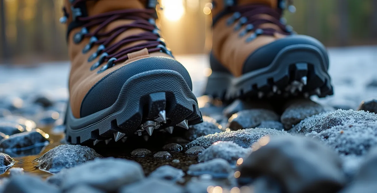
When to Switch from Hiking Boots to Micro-Spikes on the Trails?
As autumn transitions to winter in the Ottawa-Gatineau region, trail conditions can become treacherous with little warning. The most dangerous surface isn’t deep snow but a thin, nearly invisible layer of black ice. This is when hiking boots, no matter how good their tread, lose their effectiveness. The critical piece of gear for this transitional season is a pair of micro-spikes—chains and small spikes that stretch over your boots. Knowing exactly when to make the switch from simple boots to spikes is a crucial piece of seasonal trail intelligence that ensures safety and prevents a nasty fall.
The decision shouldn’t be based on what you see at the trailhead alone. Conditions can change dramatically with a small increase in elevation. A trail that is merely wet at the parking lot can be a sheet of ice just 100 metres higher up. Rocky, north-facing trails like parts of King Mountain or Luskville Falls are notorious for holding ice 2-3 weeks longer than more open, gravel paths like the Lauriault Trail. Waiting until you are already slipping and sliding is too late; the decision to bring and wear spikes must be proactive.
Instead of guessing, use a simple decision matrix based on observable conditions. The following rules of thumb, used by experienced local hikers, will help you determine if spikes are necessary for a safe and enjoyable outing:
- The Parking Lot Test: Before you even start your hike, check the puddles in the parking lot. If they are frozen solid or have a crystalline layer of ice, the trails at higher elevations will be significantly icier.
- The Temperature Rule: If the overnight low was below -2°C and the forecast daytime high is below +3°C, ice is highly probable in shaded areas. In this scenario, it’s wise to pack your spikes even if you don’t put them on immediately.
- The Elevation Factor: As a general rule, expect the temperature to drop by 1-2°C for every 100 metres of elevation you gain. This means a seemingly mild day at the base can be well below freezing at the summit.
- The Sun Exposure Clue: Always be more cautious on trails that are heavily shaded or face north. These sections receive little to no direct sunlight and can remain icy long after other trails have thawed.
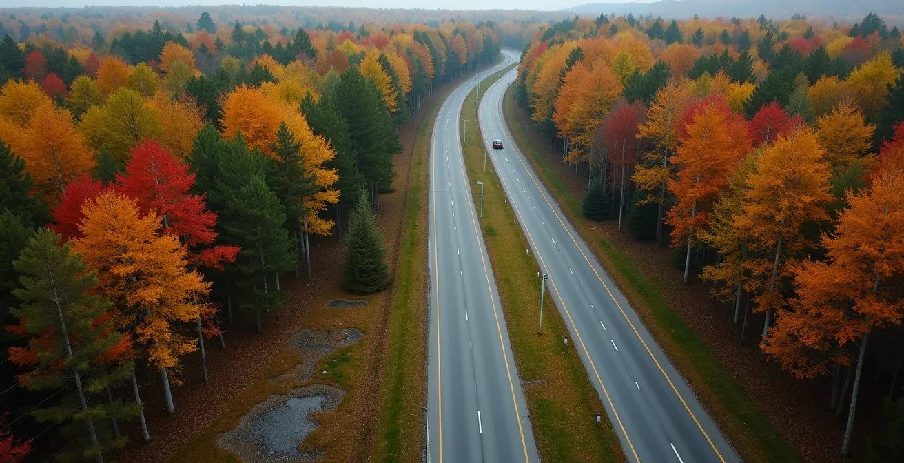
When to Visit the Greenbelt to Catch the Fall Colors at Their Peak?
While Gatineau Park gets most of the attention, Ottawa’s National Capital Greenbelt offers some of the region’s most accessible and spectacular fall foliage, often with fewer crowds. The key to experiencing the Greenbelt’s autumn brilliance is knowing that “peak colour” doesn’t happen everywhere at once. Different sections are dominated by different tree species, each with its own schedule for turning. “Seasonal sync” is paramount here; visiting the right trail during the right week is the secret to a perfect fall hike.
For example, the Red Maples surrounding Mer Bleue Bog are typically the first to ignite, usually peaking in the first week of October. Their fiery red is best viewed in the crisp morning light. A week or two later, the oaks and birches of Stony Swamp hit their stride, creating a sea of gold and rust that glows in the late afternoon. Understanding this timeline allows you to extend your fall colour viewing season over several weeks by simply changing your location.
As the Rideau Trail Association highlights in its guide to local hiking spots, places like Mer Bleue offer a unique experience. As they note:
At Mer Bleue there are 21.7 kilometres of hiking trails. A great hike is the six-kilometre forest trail that goes up to a sandy escarpment that overlooks the bog. The Mer Bleue Bog Trail is a boardwalk that allows you to explore the heart of the bog and discover its many interesting facets.
– Rideau Trail Association, 7 Places to hike around Ottawa & Gatineau Guide
This kind of specific advice helps hikers pinpoint not just where to go, but how to experience it. To maximize your fall colour tour of the Greenbelt, use the following timeline as your guide.
| Location | Dominant Trees | Peak Week | Best Time of Day |
|---|---|---|---|
| Mer Bleue Bog | Red Maples | Oct 1-7 | Morning (8-10 AM) |
| Stony Swamp | Oak & Birch | Oct 10-17 | Late afternoon |
| Shirleys Bay | Mixed Forest | Oct 5-12 | Golden hour (5-7 PM) |
| Pine Grove | Aspen & Poplar | Sept 25-Oct 3 | Midday sun |
How to Pack for a Weekend That Includes Hiking and Fine Dining?
A perfect weekend in the Ottawa-Gatineau region often involves a delightful paradox: spending the day getting muddy and sweaty on the trails, followed by an evening enjoying the sophisticated culinary scene in Old Chelsea. This “trail-to-table” transition presents a unique packing challenge. How do you prepare for both rugged adventure and refined dining without bringing your entire wardrobe? The solution lies in a smart, modular packing system that emphasizes versatile clothing and a well-planned transition strategy.
The goal is to minimize bulk while maximizing function. The core of this strategy is selecting multi-purpose base layers. A high-quality merino wool shirt is the hero of this approach. It’s breathable and moisture-wicking enough for a strenuous hike, but its natural odor-resistance means it won’t smell after a day of activity. This allows it to serve as a respectable base layer for a casual dinner outfit. The second key is what locals call the “car refresh kit”—a small, dedicated bag left in your vehicle with everything you need to quickly clean up and change.

Using packing cubes can further organize your weekend bag, creating a clear distinction between your “hike” and “dine” outfits. This system ensures your clean clothes stay fresh and makes the transition seamless. Instead of heading back to your hotel, you can use public facilities like those at the Gatineau Park Visitor Centre or in Old Chelsea to change, saving valuable time.
Here’s a simple packing system for a seamless transition:
- The Base Layer Strategy: Pack one or two merino wool t-shirts or long-sleeves that can be worn for both activities. Choose neutral colours like charcoal, navy, or olive.
- The Car Refresh Kit: Keep a small bag with body wipes, dry shampoo, deodorant, a comb, and any necessary makeup. This is your 10-minute transformation station.
- The Dining Outfit: In a separate garment bag or packing cube, have a clean collared shirt or blouse, a pair of dark jeans or chinos, and a pair of clean leather loafers or stylish flats.
- The Footwear Formula: This is a three-part system. Wear trail runners or hiking boots for the hike. Switch to comfortable driving moccasins or slip-ons for the car ride. Finally, change into your clean leather shoes right before entering the restaurant.
Key Takeaways
- True trail difficulty is defined by elevation gain and technical terrain, not just distance.
- For popular trails in peak season, arriving before 9 AM or using designated alternative parking lots is a non-negotiable strategy.
- Optimize your sunset viewing by choosing lookouts based on their orientation and the time of year (e.g., Étienne Brûlé for autumn).
How to Explore Ottawa’s Greenbelt Trails Without a Car?
Exploring the vast natural beauty of Ottawa’s Greenbelt doesn’t require a car. Thanks to the city’s public transit system, OC Transpo, and an extensive pathway network, many of the best trails are surprisingly accessible. This approach to exploration not only reduces your carbon footprint but also simplifies the logistics, eliminating any worries about parking. It’s the ultimate “minimal effort” approach to accessing nature, relying on smart planning instead of a personal vehicle.
This is possible because Ottawa is home to the Capital Pathway network, one of North America’s largest. As documented by local trail experts, there are more than 600 kilometres of multi-use paths that link the city’s parks, natural areas, and attractions. Many OC Transpo routes stop within a short walk or bike ride of these pathways, acting as gateways to the Greenbelt’s extensive trail systems. The key is to use the OC Transpo travel planner to match your desired trail with the nearest bus route or O-Train station.
For those looking to venture further, the “bus-and-bike” combination is a powerful tool. All OC Transpo buses are equipped with bike racks, allowing you to take a bus to the edge of a sector and then cycle the remaining distance to a more remote trailhead. Just be sure to check the weekend schedules, as service frequency can be reduced, especially on Sundays. With a bit of planning, a car-free hiking adventure is not only possible but also incredibly rewarding.
Here are some of the most effective car-free routes to access top Greenbelt trails:
- Mer Bleue Bog: Take OC Transpo Route 94 to Millennium Station. The trailhead for the Mer Bleue Bog Trail and its beautiful boardwalk is just a 10-minute walk from the station.
- Stony Swamp: Use Route 75 to reach Barrhaven Centre. From there, you can easily connect to the Trans Canada Trail, which provides direct access to the extensive network within Stony Swamp.
- Shirleys Bay: Take the O-Train’s Line 1 to Tunney’s Pasture Station and transfer to Route 51. This bus will take you close to the Shirleys Bay area, known for its waterfront trails and birdwatching opportunities.
Now that you are equipped with the local knowledge to hike smarter, not harder, the next logical step is to put this intelligence into practice. Choose a trail that matches your desired effort-to-reward ratio and start planning your next adventure in the National Capital Region.