Accessing Ottawa’s Greenbelt without a car is not a limitation; it’s an opportunity for a more intentional and rewarding nature experience.
- The Greenbelt’s unique design and a growing network of pathways and transit options make it surprisingly accessible from the urban core.
- Success depends on “transit-to-trail” micro-logistics, including specific packing, route planning, and safety awareness for car-free adventurers.
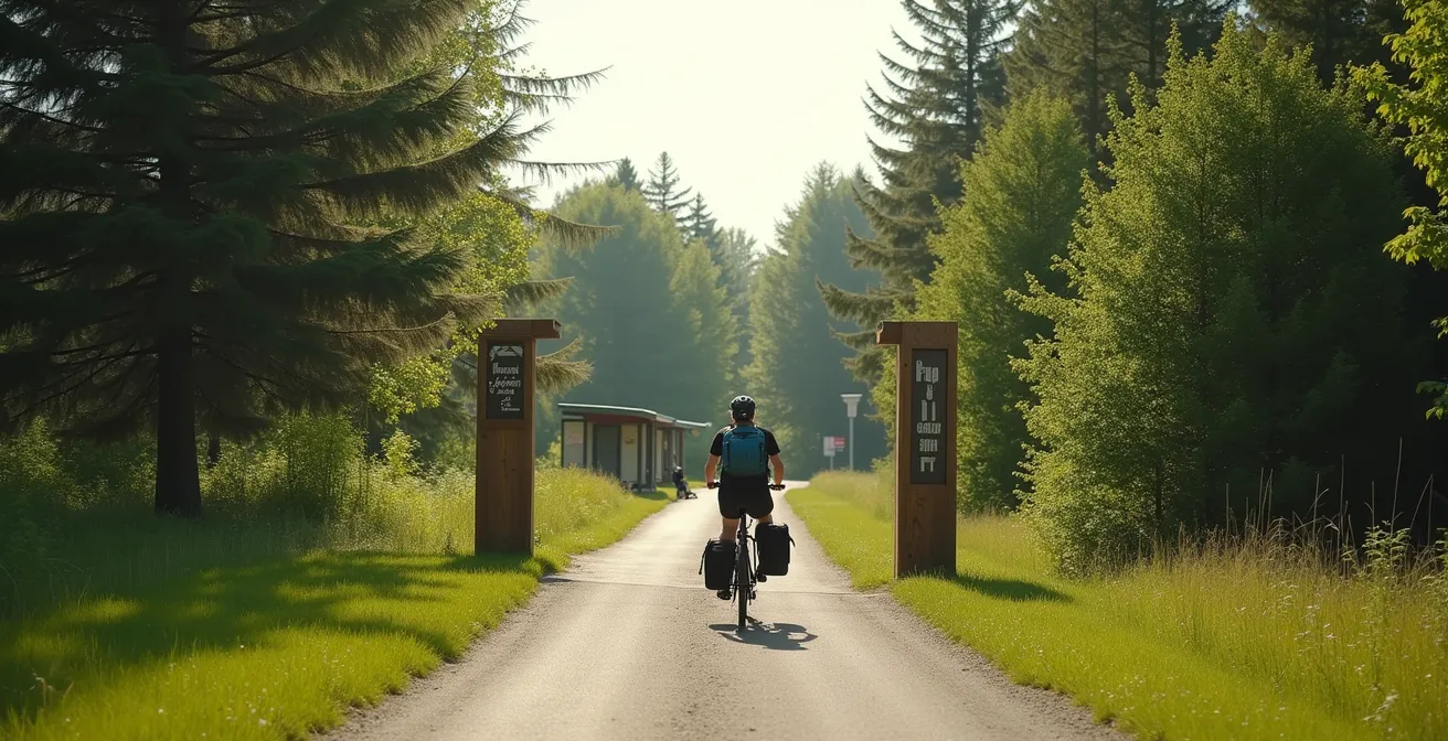
Recommendation: Instead of focusing on what’s hard to reach, start by mastering access to one transit-friendly sector, like Shirleys Bay or Pine Grove, to build your confidence and skills.
Living in the heart of Ottawa, the call of the wild can feel both close and impossibly far. You hear a cardinal’s song from your condo balcony and feel a pull toward the vast green spaces that encircle the city. For those without a vehicle, however, that pull is often met with a sense of frustration. The common advice to “just take a bus” or “ride your bike” oversimplifies the real challenges of turning a desire for nature into a day spent on the trail. It ignores the planning, the timing, and the specific knowledge required to bridge the gap between the last bus stop and the trailhead.
But what if embracing these logistics wasn’t a chore, but the very thing that made the experience more profound? The true key to unlocking the Greenbelt without a car isn’t just about finding a route; it’s about mastering the art of the “transit-to-trail” journey. This is about transforming your commute into a conscious part of the adventure, allowing for a deeper, more intentional connection with the natural world you set out to explore. This approach reframes car-free travel not as a constraint, but as a deliberate and sustainable choice that aligns perfectly with the spirit of conservation.
This guide is built on that philosophy. We will move beyond generic tips to provide a strategic framework for your car-free excursions. We’ll explore the Greenbelt’s unique design that makes this access possible, dive into the specific micro-logistics for packing and safety, compare destinations for activities like birdwatching, and even show you how to use the pathway network for advanced athletic training. Prepare to see the Greenbelt not as a place you drive to, but as an accessible wilderness woven into the very fabric of our city.
To help you navigate your car-free journey, this guide is structured to take you from foundational knowledge to specific, actionable plans. Discover how the Greenbelt is uniquely designed for accessibility, learn practical tips for different activities, and find the best routes for your next adventure.
Summary: Your Car-Free Guide to Exploring Ottawa’s Greenbelt Trails
- Why Ottawa’s Greenbelt Shape Is Unlike Any Other North American City?
- How to Pack for a Hike in Mer Bleue Bog During Tick Season?
- Mud Lake or Stony Swamp: Which Is Better for Birdwatching?
- The Wildlife Mistake That Could Cost You a Fine in the Greenbelt
- When to Visit the Greenbelt to Catch the Fall Colors at Their Peak?
- Why the “Wolf Trail” Rating Deceives Many Occasional Hikers?
- Why 20 Minutes in the Greenbelt Lowers Your Cortisol Levels?
- How to Train for a Marathon on Ottawa’s Multi-Use Pathways?
Why Ottawa’s Greenbelt Shape Is Unlike Any Other North American City?
Unlike the concentric rings of many cities, Ottawa’s Greenbelt is not a perfect circle. It’s a distinctive horseshoe, a massive ecological corridor designed with a purpose. This unique shape is the foundation of its car-free accessibility. Instead of being a barrier pushing nature further away, it creates countless points of contact with urban and suburban communities. An official overview confirms the Greenbelt’s unique horseshoe shape spans 203.5 square kilometres, creating an immense and varied landscape that intentionally borders numerous neighbourhoods.
This design wasn’t an accident; it was a strategic choice to weave nature into the city’s expansion. It means that for many residents, a trailhead is closer than they think. This philosophy of “intentional access” continues today. It’s not just about preserving land, but about ensuring people can connect with it. A prime example is the ongoing collaboration between the city and the National Capital Commission (NCC).
Case Study: The NCC and City of Ottawa Transit MOU
To improve commuting options and Greenbelt access for east-end residents, the City and the NCC signed a Memorandum of Understanding. According to the City of Ottawa, this agreement advances Transit Priority Measures along the Blackburn Hamlet Bypass and Innes Road. This strategic partnership aims to improve transit reliability while carefully minimizing the ecological impact on the sensitive Mer Bleue Bog area, proving that conservation and car-free access are shared, collaborative goals.
This deliberate planning transforms the Greenbelt from a static park into a dynamic part of the urban transportation ecosystem. The “green arteries” of OC Transpo routes and cycling pathways aren’t just for commuting to work; they are your direct conduits to wilderness. Understanding this design principle is the first step in shifting your mindset from “I can’t get there” to “How will I get there today?”
How to Pack for a Hike in Mer Bleue Bog During Tick Season?
A trip to the breathtaking Mer Bleue Bog requires specific preparation, especially during tick season (typically spring through fall). The car-free explorer faces a unique challenge: your journey starts long before the trailhead, and your packing must account for the entire “transit-to-trail” experience. With no car to serve as a gear locker, every item must be chosen with intention. This is especially critical given the known risks in the region; a recent study found that based on established blacklegged tick populations, 65% of Ottawa residents frequently visited high-risk sites.
Your packing strategy should be built around a principle of “containment and prevention.” This means protecting yourself during the hike and ensuring you don’t bring any unwanted hitchhikers back home on public transit. The key is to think in zones: your hiking clothes, which are considered a “hot zone,” and your “clean” travel clothes.

As seen in the image, simple physical barriers are your first line of defense. Light-colored clothing makes ticks easier to spot, and tucking pants into socks creates a formidable barrier. But for the car-free hiker, the post-hike routine is just as important as the pre-hike pre-check. Having a sealed bag with a change of clothes allows you to switch into a “clean” outfit at a public facility before you even think about your bus ride home, embodying smart micro-logistics.
Your Car-Free Tick Prevention Checklist: Mer Bleue Edition
- Apply DEET or icaridin-based insect repellent to exposed skin and clothing *before* boarding your first OC Transpo bus.
- Pack a small “tick kit” containing fine-tipped tweezers for safe removal and a small sealed container to store any ticks you find for later identification.
- Wear light-colored, long-sleeved shirts and long pants. Tuck your pant legs securely into your socks to prevent ticks from crawling up your legs.
- Bring a complete change of clothes in a large, sealed plastic bag. This is your “clean” outfit for the journey home.
- Before your return trip, find a restroom at a nearby community centre or park facility to change and perform a thorough tick check. Place your hiking clothes in the sealed bag.
Mud Lake or Stony Swamp: Which Is Better for Birdwatching?
For the car-free birder in Ottawa, the choice between destinations is as much about logistics as it is about species. Mud Lake and Stony Swamp are two of the Greenbelt’s premier birdwatching hotspots, but they offer vastly different experiences in terms of accessibility and environment. Choosing the right one depends on your goals for the day, your tolerance for travel, and the types of birds you hope to see. Mud Lake, part of the Britannia Conservation Area, is an urban oasis, while Stony Swamp offers a much larger, more immersive forest experience.
The primary deciding factor for many will be transit. Mud Lake is significantly easier to reach via OC Transpo, making it an ideal choice for a spontaneous morning or afternoon trip. Its compact size and boardwalk sections make it accessible to a wide range of mobility levels. Stony Swamp, on the other hand, is a sprawling ecosystem that truly rewards those who can reach its deeper sections, often requiring a combination of bus and bicycle. Its extensive network of natural trails offers the chance to find more reclusive woodland species that are absent from Mud Lake’s wetlands.
To help you decide, here is a direct comparison of the two locations from a car-free perspective, based on information provided by the NCC’s official Greenbelt hiking guides.
| Factor | Mud Lake | Stony Swamp |
|---|---|---|
| Transit Access | Route 51 to Britannia Park (10 min walk) | Limited bus service, bike recommended |
| Trail Length | 3km loop trail | 40+ km of trails |
| Key Species | Waterfowl, herons | Barred owls, woodpeckers |
| Weekend Service | Good frequency | Reduced frequency |
| Accessibility | Partially boardwalked | Natural surface trails |
Ultimately, the “better” location is subjective. If your goal is to easily see a high volume of waterfowl and herons with minimal travel fuss, Mud Lake is the clear winner. If you are seeking a longer, more challenging day in search of deep-woods birds like owls and are prepared for a multi-modal journey, the effort to reach Stony Swamp will be richly rewarded.
The Wildlife Mistake That Could Cost You a Fine in the Greenbelt
The most common and costly mistake visitors make in the Greenbelt isn’t littering or wandering off-trail—it’s feeding the wildlife. While it may seem like a harmless or even kind gesture, offering food to birds, squirrels, or raccoons can lead to a host of problems. It habituates animals to humans, making them dependent and sometimes aggressive. It can also disrupt their natural diet and spread disease. Because this behavior poses a significant risk to the ecological balance and public safety, it is strictly prohibited and can result in a hefty fine.
The National Capital Commission is the steward of this vast natural space. In fact, official records show that most of the Greenbelt is owned by the NCC, which manages its 14,950 hectares to protect its biodiversity. This ownership gives them the authority to enforce regulations designed to protect the very wildlife people come to enjoy. The rule is simple: observe from a distance, and never, ever feed the animals. A photo is a far better souvenir than a fine, and it ensures the wildlife remains wild.
For the car-free visitor, encountering injured or distressed wildlife presents another challenge. Without a vehicle to transport an animal or quickly leave an area, you need a clear protocol. Your phone is your most critical tool. First, do not approach the animal. Maintain a safe distance (at least 10 meters) and call the NCC Emergency Line at 613-239-5353. Be prepared to provide your exact location using trail markers or your phone’s GPS. If it is safe to do so, you can also contact the Ottawa Humane Society at 613-725-3166 for specific advice on injured wildlife. If you need immediate help, don’t hesitate to flag down other trail users like cyclists who may be able to assist or alert authorities faster.
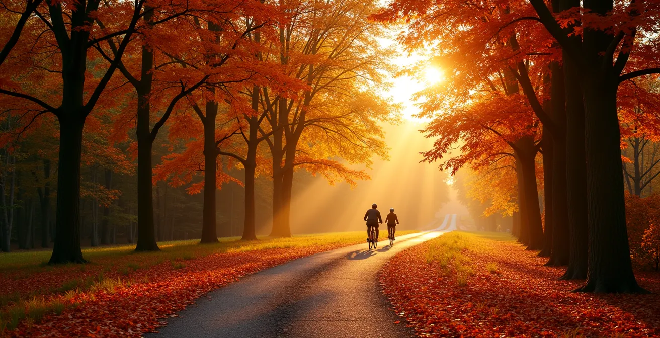
When to Visit the Greenbelt to Catch the Fall Colors at Their Peak?
Timing is everything when it comes to experiencing the spectacular fall foliage in Ottawa’s Greenbelt. While the season offers beautiful scenery from September through November, the “peak” window for the most vibrant reds, oranges, and yellows is fleeting. Generally, the best time to plan your car-free foliage tour is from the last week of September to the second week of October. This period is when the sugar maples and red oaks reach their colourful crescendo before the leaves begin to drop.
For those relying on public transit or bicycles, choosing the right location is key to a successful autumn outing. You need a destination that not only boasts a high concentration of deciduous trees but is also readily accessible. One of the best options for this is Pine Grove Forest. It offers a stunning visual display and is well-serviced by transit routes along its perimeter, making the “transit-to-trail” logistics relatively simple.
Transit-Accessible Fall Foliage at Pine Grove
Pine Grove Forest is an ideal fall destination for the car-free explorer. It features 18.4 kilometres of hiking trails that wind through a beautiful mix of native hardwood forests and historic tree plantations. The area includes a self-guided forestry interpretation trail and a unique tree-identification arboretum, allowing you to not only see the colours but also learn about the trees creating the spectacle. Its accessibility via major bus routes makes it a perfect choice for an afternoon immersed in autumn’s glory.
Imagine stepping off the bus and within minutes, walking a path lined with glowing leaves, the crisp autumn air filling your lungs. The golden hour light filtering through the canopy creates a magical, immersive experience that feels worlds away from the city centre. This is the reward for intentional, car-free planning.
Why the “Wolf Trail” Rating Deceives Many Occasional Hikers?
Many Ottawa-area hikers seeking a challenge are familiar with the legendary “Wolf Trail” in Gatineau Park, known for its steep climbs and rugged terrain. This creates an expectation for what a “difficult” trail should be. However, it’s a critical mistake to assume that trail ratings in the Greenbelt operate on the same scale, or that a high star rating on an app guarantees an easy walk. While the Greenbelt doesn’t have the same dramatic elevation changes as Gatineau Park, its trails can be deceptive in their own right, and a general rating can be misleading.
For instance, trail review platforms often show a high overall satisfaction for Greenbelt trails, which can mask the specific challenges of a particular loop. A trail might be rated highly for its beauty and wildlife, but sections could feature very rocky terrain, extensive root systems, or areas prone to seasonal flooding—challenges that are especially tough for an occasional hiker or someone with mobility issues. The Old Quarry Trail, for example, is relatively flat but its uneven, rocky surface requires constant attention and sturdy footwear. This is a nuance a simple star rating doesn’t capture.
The key is to look beyond the stars and read the details. Pay attention to recent comments about trail conditions, look for keywords like “rocky,” “muddy,” or “roots,” and cross-reference with the NCC’s official trail descriptions. For those seeking a genuine challenge without a car, the Greenbelt offers several excellent options that test endurance and skill:
- Old Quarry Trail: Accessible via transit, this trail offers fascinating geological features but demands careful footing on its rocky and uneven surfaces.
- Jack Pine Trail (Long Loop): Located in the Stony Swamp sector, this 2.3 km loop is known for its challenging, rugged terrain that feels surprisingly wild.
- Rideau Trail (Greenbelt Sections): Connecting through various parts of the Greenbelt, sections of this long-distance trail can be surprisingly remote and demanding, perfect for testing your navigation skills.
Why 20 Minutes in the Greenbelt Lowers Your Cortisol Levels?
The feeling of calm that washes over you after just a short time in nature is not just a feeling—it’s a measurable physiological response. The practice of “forest bathing,” or Shinrin-yoku, has been studied extensively, showing that spending as little as 20 minutes in a natural environment can significantly lower levels of cortisol, the body’s primary stress hormone. The Greenbelt, with its vast and ancient ecosystems, is the perfect laboratory for this practice.
It’s an experience that engages all the senses. It’s the sound of the wind in the pines, the sight of dappled light on the forest floor, the smell of damp earth, and the feeling of cool air on your skin. This sensory immersion helps to quiet the brain’s prefrontal cortex—the part responsible for planning, problem-solving, and rumination—and activates a more restful, meditative state. The Greenbelt offers countless places to have this experience, but few are as powerful as Mer Bleue Bog.
There’s a unique power in standing on the boardwalk and knowing you are in a northern boreal landscape that is more than 7,000 years old. This sense of deep time and natural stability provides a profound psychological anchor, putting daily stresses into perspective. For city dwellers, this accessible escape is an essential tool for mental well-being, and the car-free journey enhances it. The walk from the bus stop and the deliberate pace of the hike become a transition, allowing the mind to shed the city’s noise before you even arrive.
For many Ottawa residents, access to the Greenbelt is just steps from their front door and, for cyclists, it can be just a few minutes away.
– National Capital Commission, Greenbelt Visitor Info
This proximity is a gift. It means stress relief isn’t a weekend-only luxury; it’s a daily possibility. A 20-minute investment in your well-being is waiting for you, just an ecological commute away.
Key Takeaways
- The Greenbelt is a masterpiece of urban planning, intentionally designed with a horseshoe shape to maximize access points for city residents.
- Successful car-free exploration hinges on mastering “transit-to-trail” micro-logistics, from packing for tick season to planning multi-modal journeys with buses and bikes.
- Each Greenbelt sector offers a unique experience; choose your destination based on your activity (e.g., Mud Lake for easy waterfowl viewing, Stony Swamp for deep-woods birding) and transit tolerance.
How to Train for a Marathon on Ottawa’s Multi-Use Pathways?
For the dedicated runner, Ottawa’s Greenbelt is more than a place for gentle hikes; it’s a world-class training ground. Using its extensive network of multi-use pathways for marathon training is the ultimate expression of intentional, car-free living. It allows you to build endurance, practice on varied terrain, and complete long runs without ever needing to circle the same city block or drive to a starting point. The key is to leverage OC Transpo’s O-Train and major bus hubs as strategic start and end points for your long runs.
This “transit-to-trail” training method allows for incredible flexibility. You can plan long, one-way runs and simply hop on the train or bus for a relaxed ride home, eliminating the dreaded out-and-back fatigue. The Greenbelt pathways connect seamlessly with the broader Capital Pathway network, including the Ottawa River and Rideau River pathways. This integration means you can design routes of almost any length, from a 10k tempo to a full 42.2k practice run, all while passing through beautiful natural scenery.
The network is well-equipped for runners. Many sections of the Capital Pathway feature water fountains (check seasonal availability) and public washrooms at key locations like Britannia Beach or Andrew Haydon Park. For triathletes or those looking to practice “brick” workouts (bike-run), the OC Transpo “Rack & Roll” program is a game-changer, allowing you to cycle one leg of your journey and run the other. Here are a few sample routes designed around major transit hubs:
- The Confederation Line Run (21km): Start at Blair Station and run west along the Greenbelt Pathway East and Ottawa River Pathway to Tunney’s Pasture Station. Enjoy a traffic-free half-marathon and take the O-Train back.
- The Western Parkway (18km): Take a bus to Lincoln Fields Station and run west toward Green’s Creek, using the scenic parkway paths with options for water stops at Britannia.
- The Southern Connector (24km): Begin near Billings Bridge, connect to the Rideau Trail and Capital Pathway network, and run west toward the Shirleys Bay area for a challenging, long-distance route.
Your next nature escape is just a bus or bike ride away. Start planning your intentional, car-free Greenbelt adventure today and rediscover the wilderness within your city.